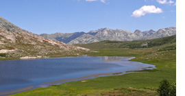
The GR20, from Calenzana to Conca
The "classic" path of the GR20 is a two week trek. But you can also try a GR20 North and a GR20 South trek, each of which can be completed in around a week.
The GR20 requires experience of mountain walking. Where this is not possible, then confidence in your physical condition is a necessity. It is not a technically challenging hike but does require some scrambling, use of chains and a ladder (on the Northern section) and a sure footedness for the rocky landscape and mountain ridges.
The average daily walking time for proficient walkers is 6.5 hours (not including stops), but with several days over 8 hours and with considerable daily ascents and descents (averaging +800m and -500m per day).
To undertake this walk self-guided, you need to be a confident mountain walker, able to read route notes and most importantly, be able to locate your position on a map and navigate your way when necessary. You need to be confident in the face of challenges and difficult conditions. You should be well equipped and well prepared.
The terrain
Even if the GR20 is in a low mountain region, it is not technically a trail but rather an itinerary going across the mountains on the island. It has several technical sections with rocky passages and steep descents. The altitude gain and loss requires great physical effort and can be tough on the thighs (quadriceps and hamstrings). Considered as the most technical part, the northern section is set in an alpine mineral environment. As for the southern section, the difference in altitude is not as great as in the north but the distances are greater. The GR20 is also very different from the grandes randonnées of the Alps or the Pyrenees as loose rocks and stones are tough on the feet.
If you’re planning on walking the GR20, it is really important not to underestimate how tough the trek is. In fact, many Corsicans say that toughness is its raison d’être.
GR20 North to South or South to North?
There is much debate around which way you should actually walk the GR20. Even local experts don’t actually agree on which version is best.
Some prefer to do the GR20 from North to South from Calenzana to Conca for the following reasons:
- when the GR20 was first created in 1972, the starting point chosen by Fabrickant was Calenzana and the ending point was Conca.
- the most technical sections of the trail are situated on the northern part and it could be thought best to start the most difficult part when you still have plenty of energy left.
Others prefer to start from the South from Conca to Calenzana for one major reason:
- mountains on this part of the GR20 are less technical than in the north. Doing the GR20 from South to North is a good way to start from the easiest part of the trail and to finish with the most difficult one. It’ll enable you to get used to the rough terrain in the easier section and gradually increase in difficulty.
- starting from Bavella means that you will be walking with the sun on your back and will have better sight of where you are heading.
gr20.co.uk > the stages

The stages of the GR20
Here is a 12-stage itinerary. You can read a detailed description of the stages.
D1 – From Calenzana to Bonifatu.
D2 – From Bonifatu to Haut Asco.
D3 – From Haut Asco to Vallone sheepfold.
D4 – From Vallone to Verghio.
D5 – From Verghio to refuge de la Sega.
D6 – From la Sega to Corte.
D7 – From Corte to Vizzavona.
D8 – From Vizzavona to Capanelle.
D9 – From Capanelle to col de Verde.
D10 – From col de Verde to Cozzano.
D11 – From Cozzano to Basseta.
D12 – From Basseta to Bavella.

